In this Article
- Leaving Little Rock for 1.8 Million Acres of Logging Road
- Fist-Sized Shale After a Grader Passes
- Forty-Five Millimeters on the Steep Stuff
- Lake Sylvia as Hub, Winona as the Tax
- No Bars, a Filter, and a Spare Hanger
- Over-Tire the Bike and Sandbag the Clock
Leaving Little Rock for 1.8 Million Acres of Logging Road
The Ouachita National Forest encompasses 1.8 million acres of land. Sit with that acreage before clipping in. It is an immense grid of unpaved logging roads, fire traces, and ridge cuts that can swallow a Saturday and still leave another drainage unexplored.
The transition from Little Rock city limits to the eastern edge of the forest takes roughly 35 to 45 minutes by car. Close enough to feel like a local errand. Remote enough that a sidewall cut becomes a walk with no hatchback on the way. Riders who treat that drive as a simple extension of the Arkansas River Trail discover the support network vanishing: no corner store, no reliable bars, no friendly wheel to draft.
Sheer size creates the tension. Isolation means standard road cycling preparation fails in quiet, expensive ways. A single spare tube that would have covered a city puncture does nothing when shale opens a casing around six miles past the last cabin. Bottles that last a training interval on pavement run dry on a loose climb that refuses to crest. The foothills demand a different inventory and a slower head.
The appeal lives in the same distance that creates the risk. West of the city, terrain turns rugged and unpredictable. Chunk under the tire. Shade that actually cools. A ridgeline that pays for the grind. Little Rock pavement cannot manufacture that feeling. The community that chases it treats the forest as fieldwork: gradients, shoulders, surfaces, traffic windows, water stops, and bail-out options, drawn like a route card rather than a casual loop.
What remains after the first cattle guard is surface, weather, and the decision to keep rolling when the next intersection is two dirt roads with no sign.
Groups leaving town on a Saturday still talk about watt targets and gear from the week. Those conversations fade fast. The forest does not care about last week's group-ride average. It cares whether the kit on the bike matches the grid of logging roads ahead.
Fist-Sized Shale After a Grader Passes
Newcomers ask the same question after the first mile of a freshly worked road: why does this surface chew through rubber that survived Midwestern dirt all spring?
Arkansas gravel rarely presents as smooth champagne. Freshly graded logging roads frequently expose jagged shale chunks roughly 2 to 3 inches across. Those edges sit proud of the bed and find the thinnest part of a casing. Seasonal weather then rewrites the corridor. Heavy spring rains can wash out established creek crossings within about a 12- to 24-hour window. A line that rolled clean on Thursday becomes a trench on Friday, and the same GPS track that felt friendly in October turns hostile after a wet March.
Forestry equipment compounds the swing. A grader can refresh a road into a bowling lane of loose, sharp rock overnight. While local shop experience provides a baseline, recent heavy rains or forestry equipment can change a route's surface overnight. Check the official Ouachita National Forest alerts and maps before loading the car. Updates from flatter states will not warn anyone about a Tuesday cut that buried the packed line under fist-sized rock.
Washes Out Overnight
A packed creek crossing can vanish inside a day after a heavy spring cell. If the forecast dumped rain on the western ridges, treat every mapped ford as unconfirmed until the wheel is on it.
Riders who respect the surface ride the high, packed ribbon when it exists and accept walking a roughly fifty-yard washout as part of the outing. Charging the chunk with road-race line choices only feeds tire damage from Ouachita shale — service-counter logs around the foothills register as much.
Forty-Five Millimeters on the Steep Stuff
Beginners often arrive on cyclocross rubber because that is what last season's marketing sold as gravel ready.
The early experiment is a known story around these ridges. Initially, local riders attempted to navigate the foothills using standard 35mm cyclocross tires, but frequent pinch flats on the sharp shale led to a widespread shift toward 45mm tubeless setups as the regional baseline. The minimum recommended tire width is 40mm, with 45mm or larger being ideal for descents. Volume is the armor. Width lets the casing float over proud rock instead of pinching against the rim.
Tubeless setups belong on every bike that enters this forest. Sharp Ouachita shale will find a tube. Sealant and a loaded plug kit keep a ride moving when a cut would have ended it. Carry extra plugs. The forest does not care that the first strip already went into a sidewall at around mile eight.
Geometry finishes the picture. Gravel-specific frames such as the Giant Revolt use slack head tube angles typically ranging from 70.5 to 71.5 degrees for stability on loose, steep gradients. The Liv Devote brings that same relaxed front end into women's-specific geometry, which keeps the wheel from darting when the surface turns to marbles on a descent. A slack angle buys time. Time is what keeps a loaded bike from washing out on a loose pitch.
Volume Before Aero
If the fork has the room, run the bigger tire. Claimed aero savings on these roads evaporate the moment the surface turns to shale. Traction is the efficiency that matters on a foothill descent.
Riders who already run 45mm still check actual inflated width against the stays. Packed mud and shale will rub. Clearance is a measurement taken with a dirty bike.
Lake Sylvia as Hub, Winona as the Tax
Lake Sylvia recreation area works as a prime starting hub for gravel loops. Parking, a known trailhead, and a cluster of logging spurs that peel into the eastern Ouachitas give riders a clean launch without guessing at a random gate. Groups staging here can split into short connectors or commit to the ridge.
Staging Without Guesswork
The recreation area gives a shared clock. People meet, check kits, and roll together onto dirt before the forest swallows the group. That simple ritual beats hunting a shoulder on a numbered highway.
Paying for the Ridge
The climb up to the Winona Scenic Drive is the tax. The climb from Lake Sylvia to Winona Scenic Drive involves a sustained roughly 4- to 6-mile ascent. The ascent averages around a 5 to 7 percent gradient on loose aggregate surfaces. That gradient on packed pavement would be a tempo effort. On loose rock it becomes a traction puzzle. Seated climbing spins the rear tire. Standing punches the front into a wash. Riders learn to pick a gear that keeps the wheel hooked up and accept a lower cadence than their road training ever prescribed.
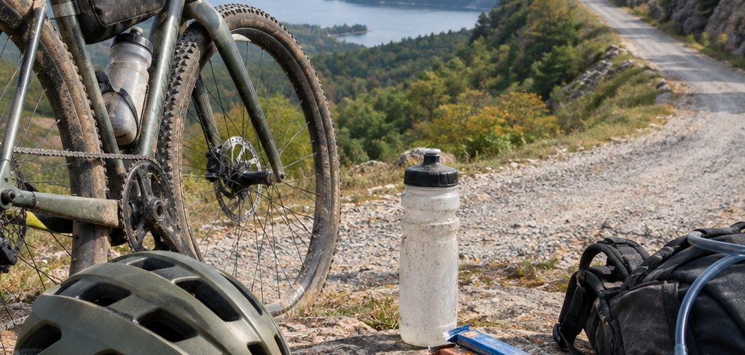
The reward sits on top. Sweeping ridge-line views open once the grade finally relents, a tangible goal for anyone who left Little Rock before sunrise. The forest canopy drops away. The next drainage appears as a dark fold. That vista is why this community keeps coming back to this particular route.
Riders who treat Winona as a pure fitness test miss the surface lesson. The climb is a skills session disguised as elevation. Look ahead for the packed ribbon. Unweight the front over proud shale. Save a match for roughly the last mile, where the aggregate often gets looser as traffic thins. Arrive at the scenic drive with enough legs to enjoy the roll, because the descent will ask for the same traction the climb just spent.
No Bars, a Filter, and a Spare Hanger
Can a phone blue-dot replace a head unit out here?
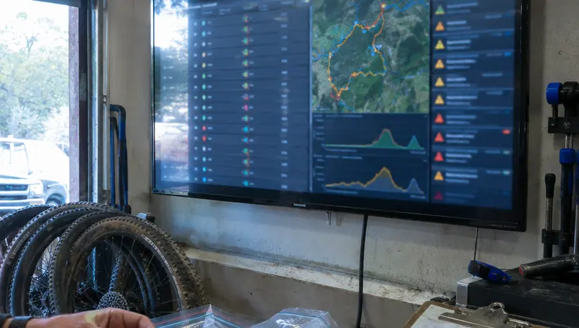
Cellular dead zones typically begin within 2 to 3 miles of entering the deep forest boundaries. Dead zones on the Winona Scenic Drive arrive faster than most riders expect. Downloaded GPS routes on a head unit are essential. Phone maps that need a tower will go blank. Load the track the night before. Ride the breadcrumb.
Dead Zones Start Early
Two to three miles sounds trivial until the last bar dies and the junction still sits in a guess. A head unit with the file stored locally turns that silence into a non-event. Paper backups still earn a pocket for long days.
Creek Water Has a Season
Hydration is the second logistics problem. Carry a water filter to pull from mountain creeks during long summer efforts. Hollow-fiber water filters capable of processing about 1 liter per minute are standard for creek refills. That flow rate turns a creek stop into a short pause rather than a camp chore.
Relying on mountain creeks for hydration is viable during the spring and early summer, but late August dry spells frequently reduce these water sources to stagnant pools, requiring riders to carry their entire fluid supply from the trailhead. Plan the season. Spring means filter and go. Late summer means bottles and a bladder filled at the car.
Self-sufficiency covers the rest. Carry a robust repair kit, extra plugs, and a spare derailleur hanger specific to the frame. A bent hanger in the wrong drainage ends the day.
Ouachita Backcountry Self-Sufficiency Kit
- Hollow-fiber water filter (1L/min flow rate minimum)
- Spare derailleur hanger specific to your frame
- Tubeless plug kit loaded with at least 5 thick repair strips
- Offline GPS route downloaded directly to head unit
Pack The Filter
In spring and early summer, a hollow-fiber filter is lighter than the extra bottles otherwise hauled up the ridge. In late August, fill everything at the trailhead and treat creeks as scenery.
Over-Tire the Bike and Sandbag the Clock
Over-tire the bike and under-estimate average speed. Hold that as the one rule that keeps Ouachita days from turning into trudges.
Average speeds in the Ouachitas typically drop 3 to 5 mph compared to standard midwestern gravel routes. Build the day around that drop. A loop that looks friendly on paper becomes a full daylight commitment once the shale and the grades start collecting minutes.
Drop tire pressure slightly lower than the standard gravel setup. Tire pressures are often run 2 to 4 psi lower than manufacturer recommendations for a given rider weight to maximize traction and comfort over aerodynamic efficiency. Soften the casing. Let the tire envelop the rock. Hands last longer. The rear wheel hooks up on the Winona pitch instead of painting a rooster tail of loose aggregate.
Embrace the rugged nature of Arkansas gravel. Let the bike float. Let the clock go. Come home with a dirty drivetrain and a finished loop, because the riders who keep showing up for these foothills are the ones who packed extra rubber and left the ego split at the cattle guard.